
Can a topographic device fit into your pocket?
Mobile Topographer now goes Pro…
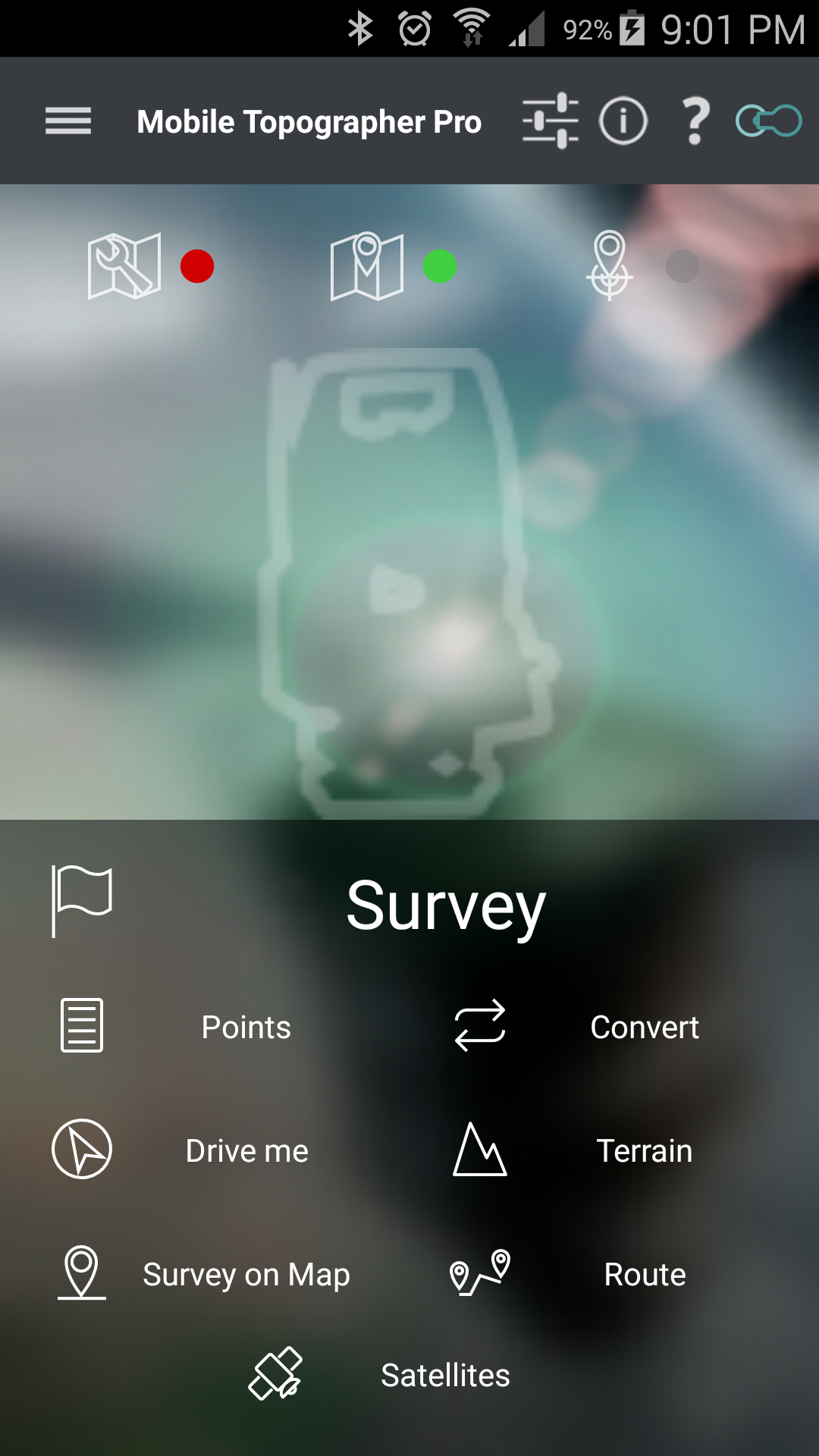
Mobile Topographer Pro is an innovative app, for the professional surveyor. It is an extension of Mobile Topographer Free including all its features and many more. Use it to collect points at the field and create a drawing of the area with contours and a 3D terrain model, fast, easily, and more accurate than ever before with a handheld device.
Your first step into the GIS world.
Only in Pro:
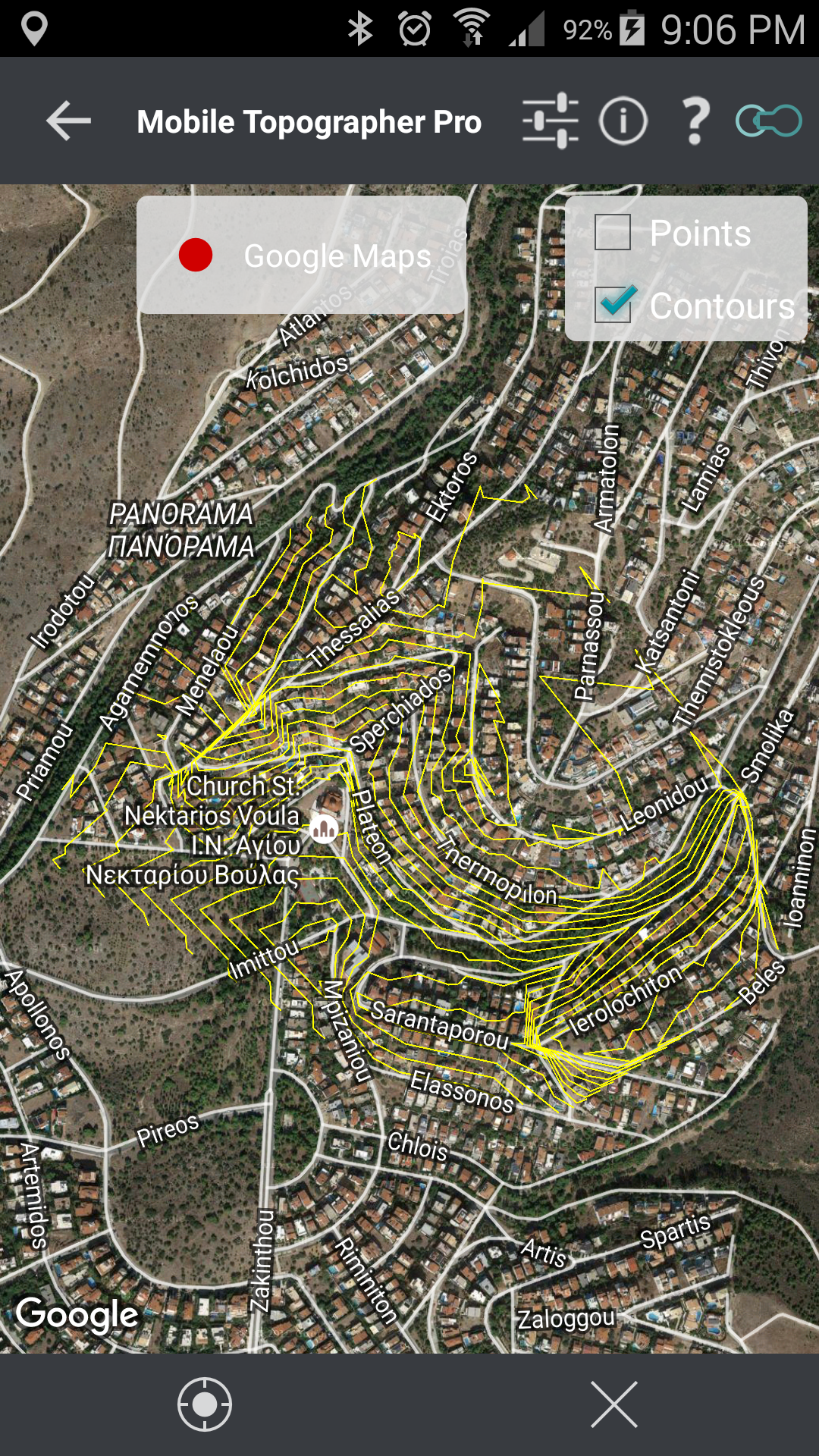
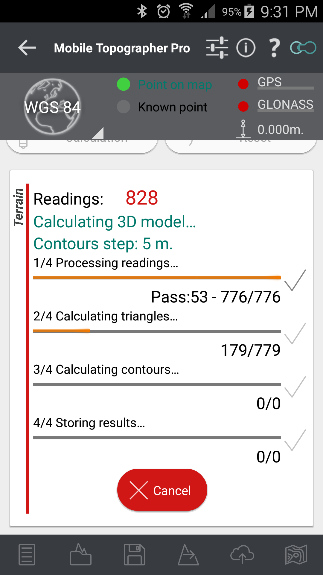
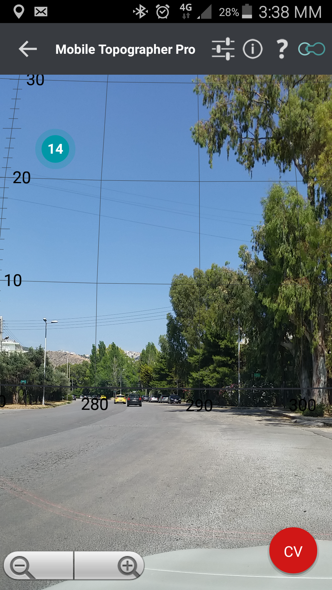
![]() 3D Terrain modeling & contours
3D Terrain modeling & contours
– Collect terrain data.
– Create a 3D terrain model.
– Create contours.
– Export data, 3D terrain model and contours in .txt, .csv, .kml, .db, .dxf files.
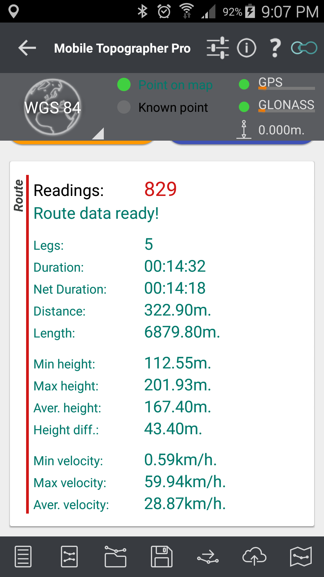
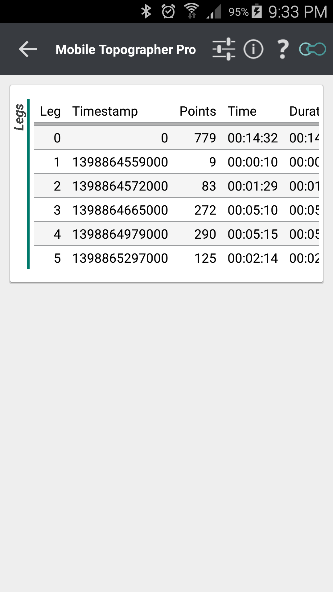
![]() Route Tracking
Route Tracking
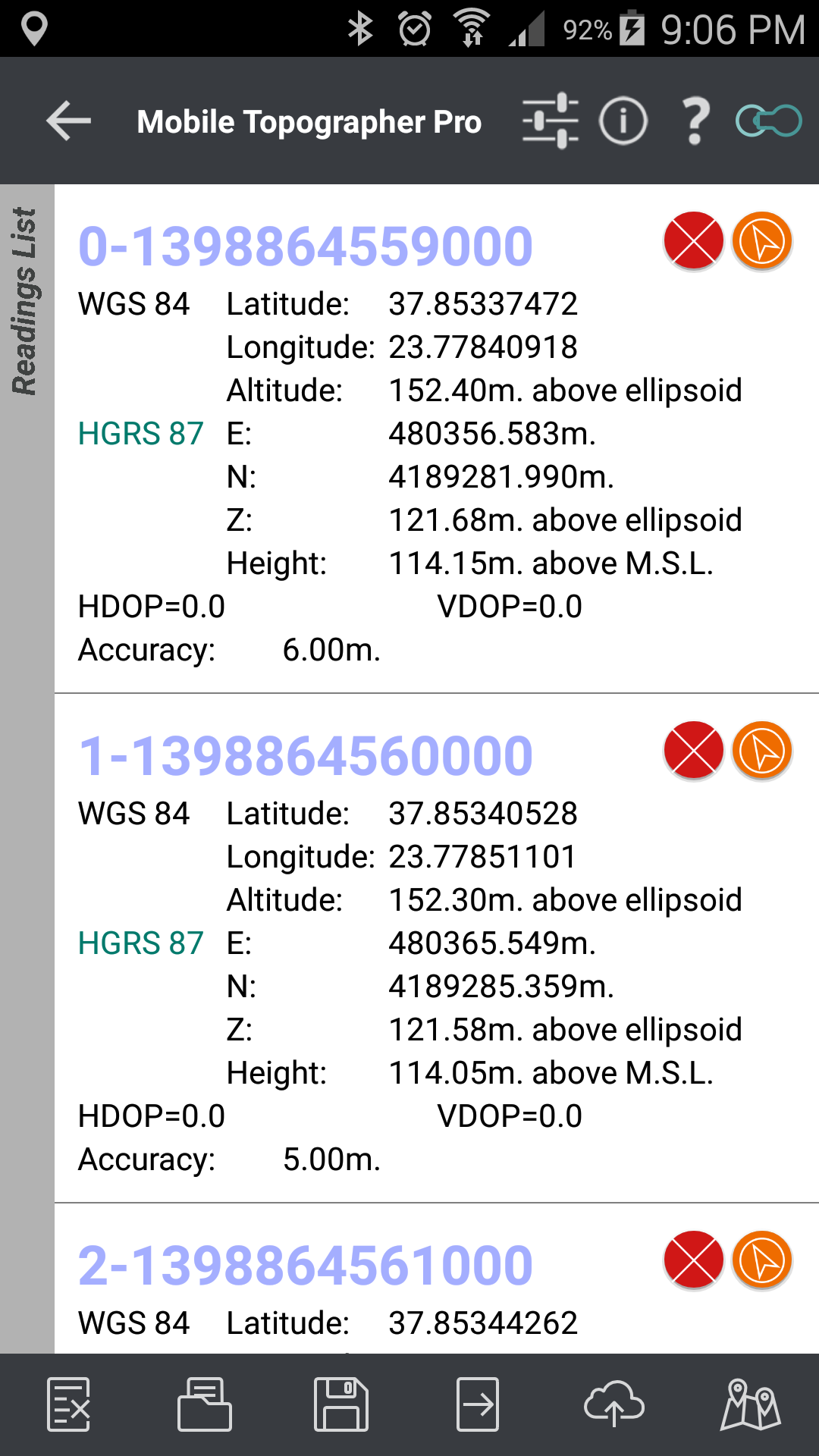
– Collect data as you move.
– Pause resume function.
– Calculate statistical data of the track and each leg of it.
– Duration – Time.
– Distance – Length.
– Minimum – Maximum – Average height – Height covered.
– Minimum – Maximum – Average velocity.
– Export data and calucation in .txt, .csv, .kml, .db, .dxf files.
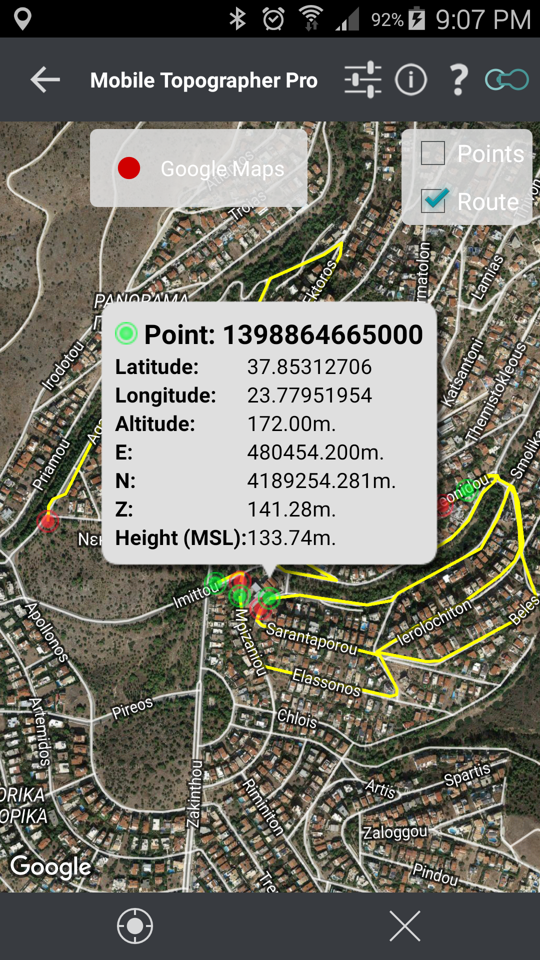
![]() Real time projection on Google Maps while “Surveying” and “Drive me”.
Real time projection on Google Maps while “Surveying” and “Drive me”.
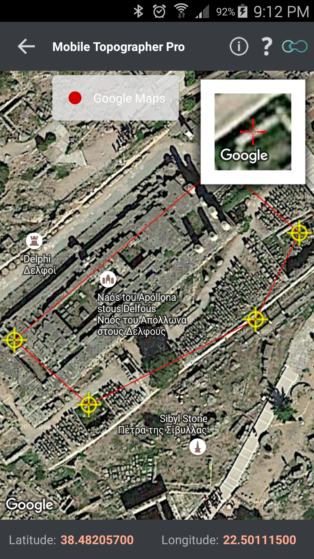
![]() Map survey
Map survey
– Complete a survey without even going to the field.
– Insert, modify or delete points directly on the map.
– Map survey can also be used to correct or make additions to an existing survey.
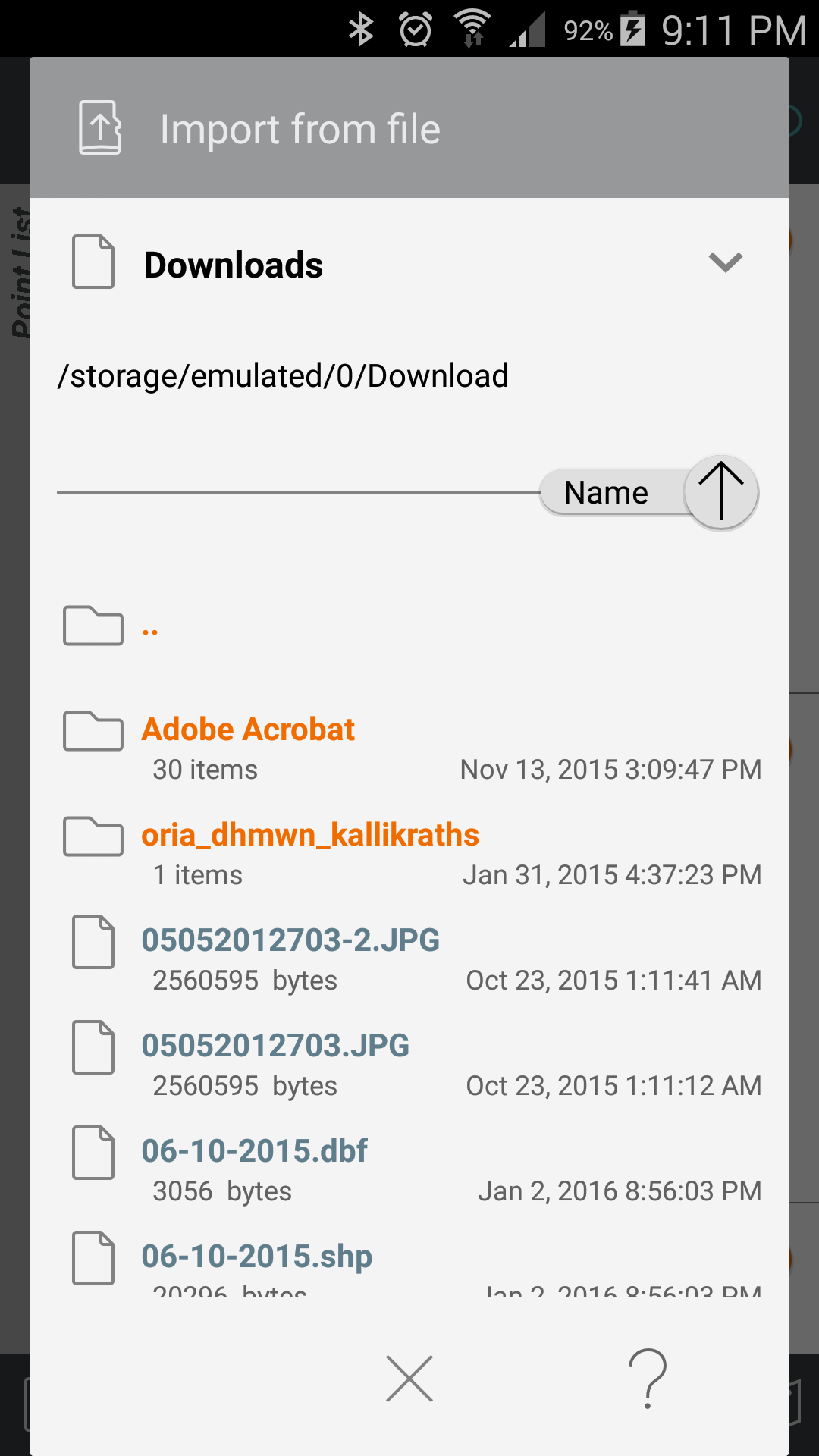
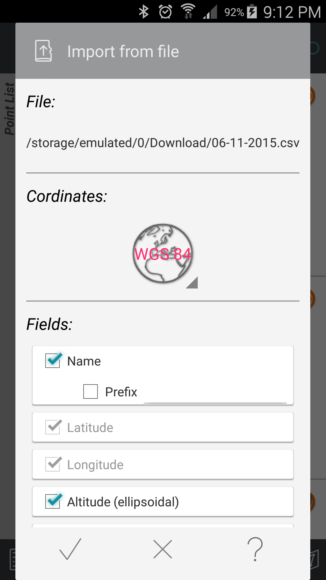
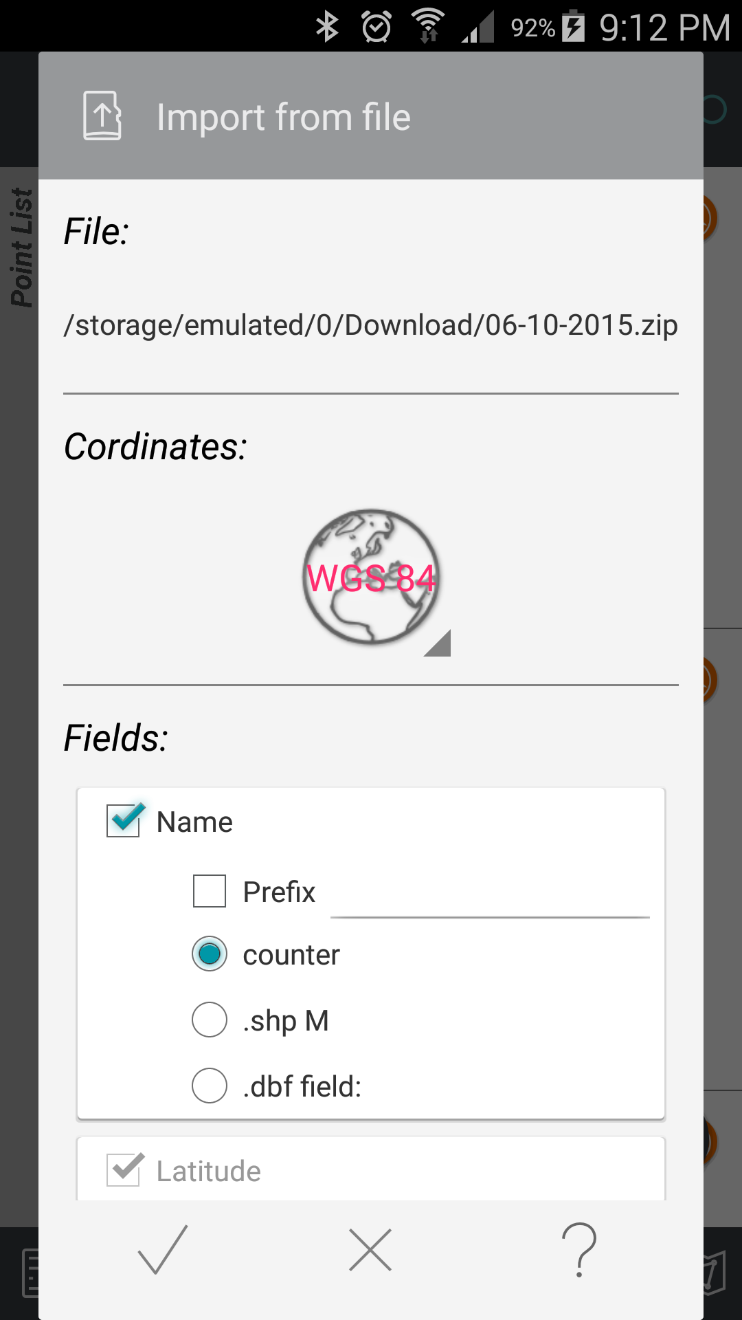
![]() Import points
Import points
– Import points from a data file.
– Text files (.txt, .csv) and Shape files (.shp) are supported.
– WGS84 file format or selected Local Coordinates Reference System format.
– Fields selection.
– Delimiter of text file selection.
![]() Export points to:
Export points to:
– .txt (text file)
– .csv (point file – comma seperated)
– .kml (google earth file)
– .gpx (GPS Exchange format)
– .dxf (drawing file)
– .shp, .shx, .dbf (Shape files)
![]() Group points
Group points
– Divide your list of points in groups depending on point names.
– Filter list of points view by naming groups.
– Export list of points with group division.
– Select the contents of the exported lists of points.
![]() Weather data
Weather data
![]() Swipe from left to view satellites in sky view while surveying.
Swipe from left to view satellites in sky view while surveying.
![]() Device elevation
Device elevation
![]() Area, perimeter, number of vertices of a plot
Area, perimeter, number of vertices of a plot
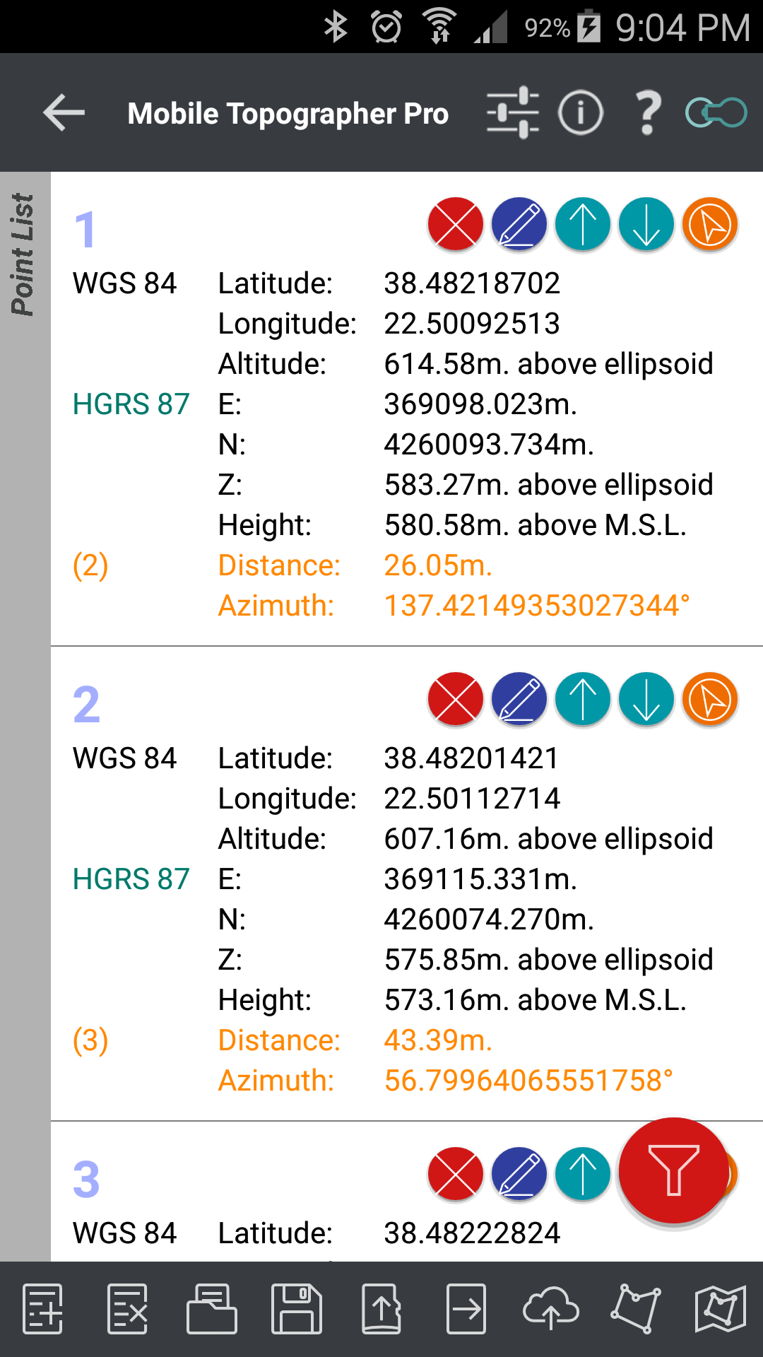
![]() Manually edit the coordinates of a point on the list
Manually edit the coordinates of a point on the list
– Directly key in the label, the coordinates and the height of a point.
– Drag & drop a point to its new position on the maps.
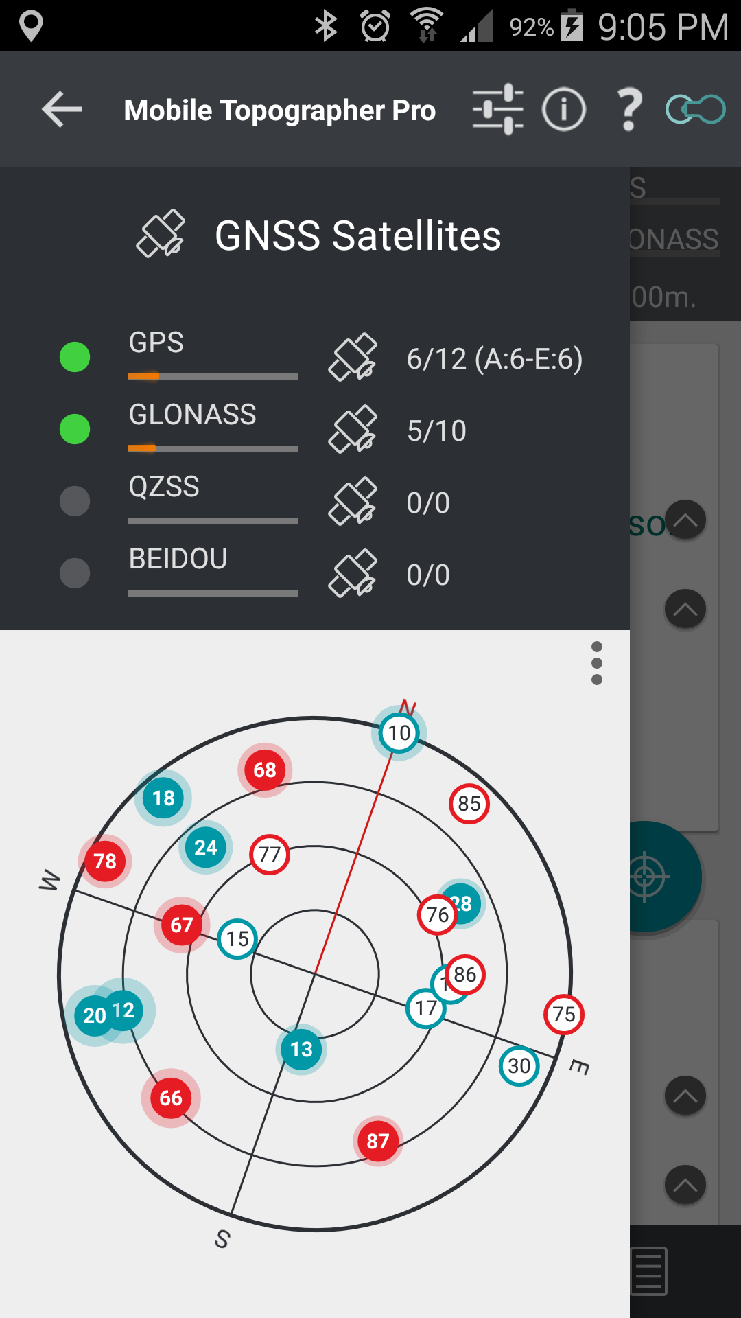
![]() View the GNSS satellites in an Augmented Reality View
View the GNSS satellites in an Augmented Reality View
– Turn your device to any direction and locate visible satellites on the physical background.
![]() Fully functional even without internet connectivity
Fully functional even without internet connectivity
![]() Google Maps v2
Google Maps v2
![]() Increased accuracy
Increased accuracy
Plus the well known features of Mobile Topographer Free:
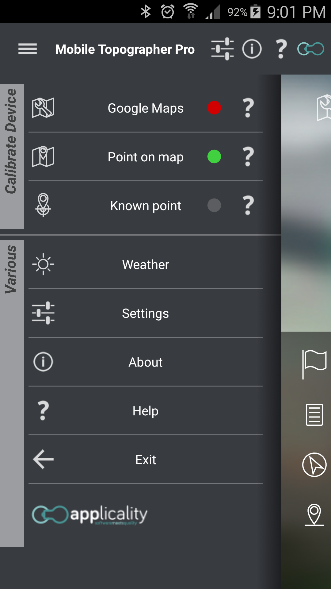
![]() Increase GPS accuracy using:
Increase GPS accuracy using:
– Weighted averaging (on every axis).
– Map calibration.
– Device calibration on map, or on a know point.
– Auto stop for accurate positioning.
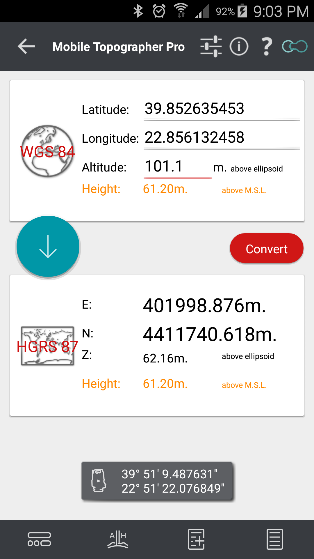
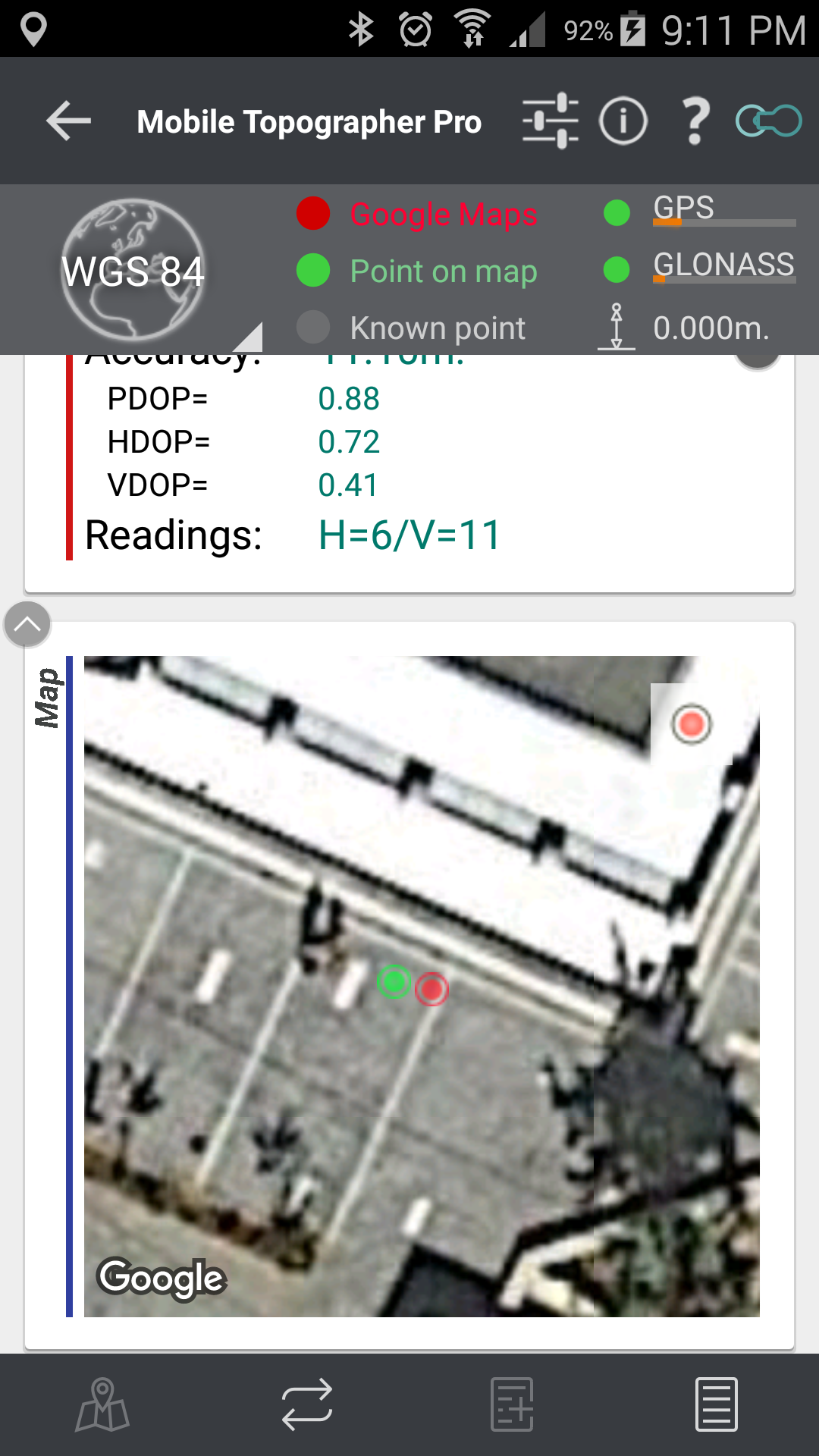
![]() Display and convert GPS geodetic to cartesian EN coordinates and back:
Display and convert GPS geodetic to cartesian EN coordinates and back:
– Real time conversion from geodetic (Latitude, Longitude) to Cartesian (E, N, Z, orthometric Height) and vise verse.
![]() Examine the satellites above you in a sky view.
Examine the satellites above you in a sky view.
![]() Signal strength and number of satellites indication for each GNSS constellation individually.
Signal strength and number of satellites indication for each GNSS constellation individually.
![]() Multiple units support:
Multiple units support:
– Metres,
– International feet,
– US survey feet.
![]() Height calculation:
Height calculation:
– Ellispoidal height.
– EGM96 orthometric height calculation.
![]() Convert from geodetic to cartesian coordinates and back:
Convert from geodetic to cartesian coordinates and back:
– Support for device measured points, or
– Manualy input of geodetic or cartesian coords.
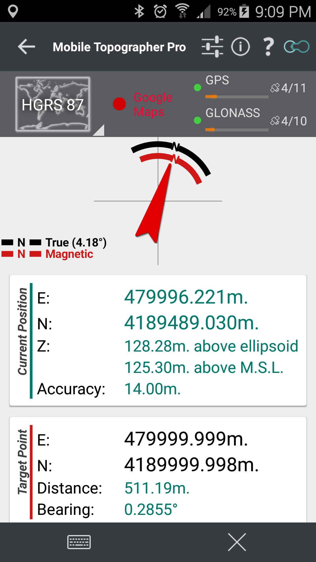
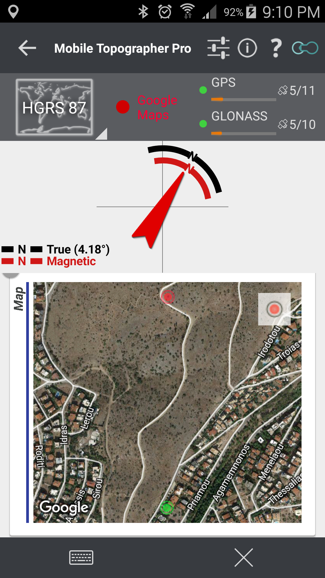
![]() Drive me:
Drive me:
– Key in coordinates of the target point in either geodetic or cartesian coordinates, or select a point from the list and follow the pointer.
– Compass indicating both magnetic and true North.
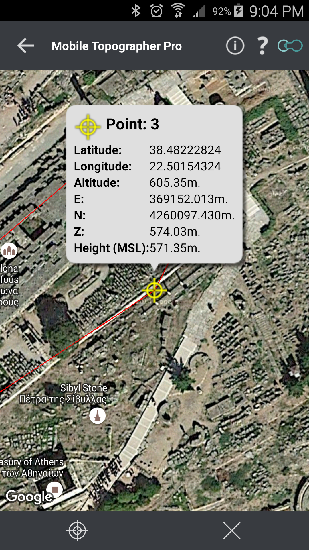
![]() Project on Map:
Project on Map:
– Project individual points on any map application.
– Project list of points, and the defined polygon, on embeded Google maps.
![]() Save multiple point lists, to use them later.
Save multiple point lists, to use them later.
![]() Calculate distance and azimuth.
Calculate distance and azimuth.
![]() Calculate area.
Calculate area.
![]() Export point lists το:
Export point lists το:
– .txt (text file)
– .csv (point file – comma seperated)
– .kml (google earth file)
– .gpx (GPS Exchange format)
– .dxf (drawing file)
![]() Send file via e-mail, or upload it to Google Drive, Dropbox, etc.
Send file via e-mail, or upload it to Google Drive, Dropbox, etc.
![]() Complete help text support.
Complete help text support.
Help us improve Mobile Topographer by e-mailing your comments and suggestions.

Supported Coordinates Reference Systems…
How to use Mobile Topographer Pro…
How to import a point list file from your home computer…
Privacy Policy