
It all started here…
A simple but effective application that brought increased accuracy, geodetic to Cartesian coordinates transformation and projection on maps. A simple tool built to help Greek surveyors, civil engineers, and architects.
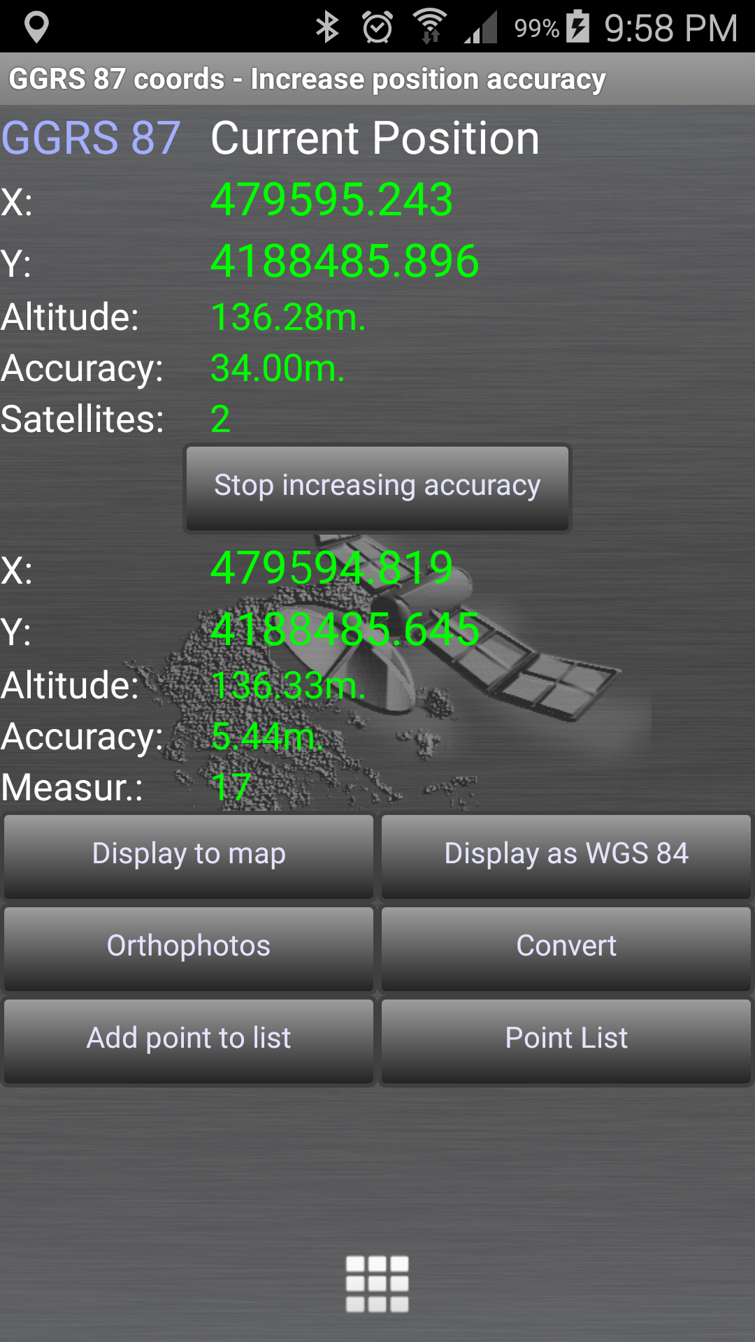
![]() Increase GPS accuracy.
Increase GPS accuracy.
– Calculate weighted average positioning.
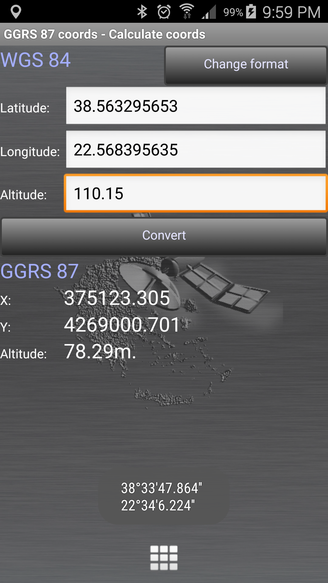
![]() Display and convert GPS coords to the Greek Geodetic Reference System GGRS 87 (EGSA 87 – ΕΓΣΑ 87).
Display and convert GPS coords to the Greek Geodetic Reference System GGRS 87 (EGSA 87 – ΕΓΣΑ 87).
– Real time while positioning.
– Key in WGS84 coords and covert to GGRS87 (ΕΓΣΑ87).
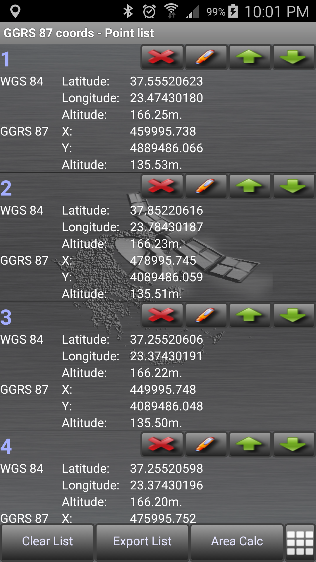
![]() Save points to lists.
Save points to lists.
– Save and reload list of points
![]() Calculate area.
Calculate area.
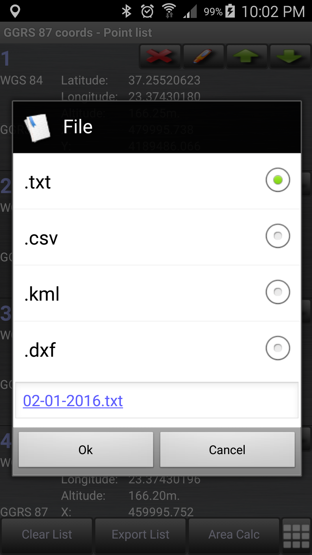
![]() Export point lists το:
Export point lists το:
– .txt (text file)
– .csv (point file – comma seperated)
– .kml (google earth file)
– .dxf (drawing file)
![]() Send file via e-mail, or upload it to Google Drive, Dropbox, etc.
Send file via e-mail, or upload it to Google Drive, Dropbox, etc.