
GNSS satellites above you are now visible!
GPS Satellites Pro is a new app, for anyone who wants to get more info about GNSS satellites. Knowing where exactly each satellite is up in the sky, not only helps understanding how GNSS systems are working, but also helps evaluate the quality of positioning data.
Welcome into the world of Augment Reality!
Locate the GNSS satellites above you using a Compass View or Augmented Reality Projection
GPS, GLONASS, QZSS, BEIDOU & GALILEO constellations are supported.
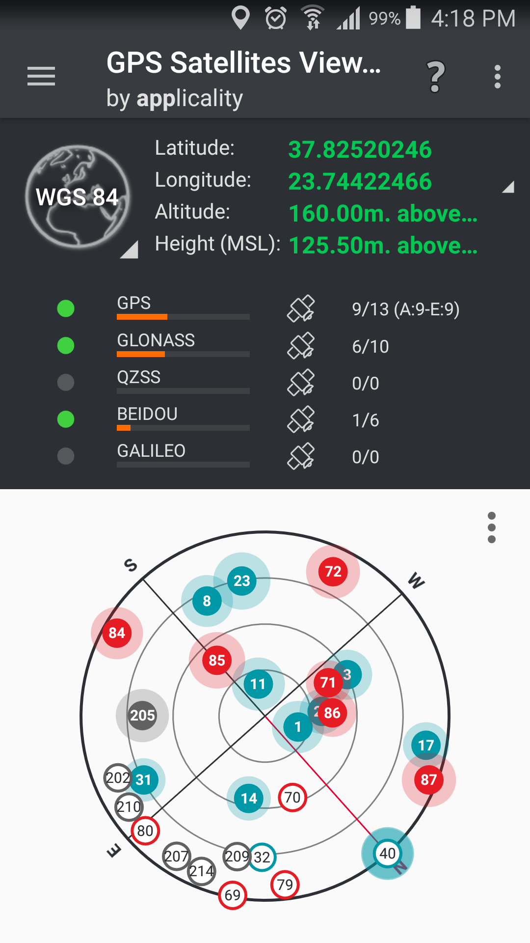
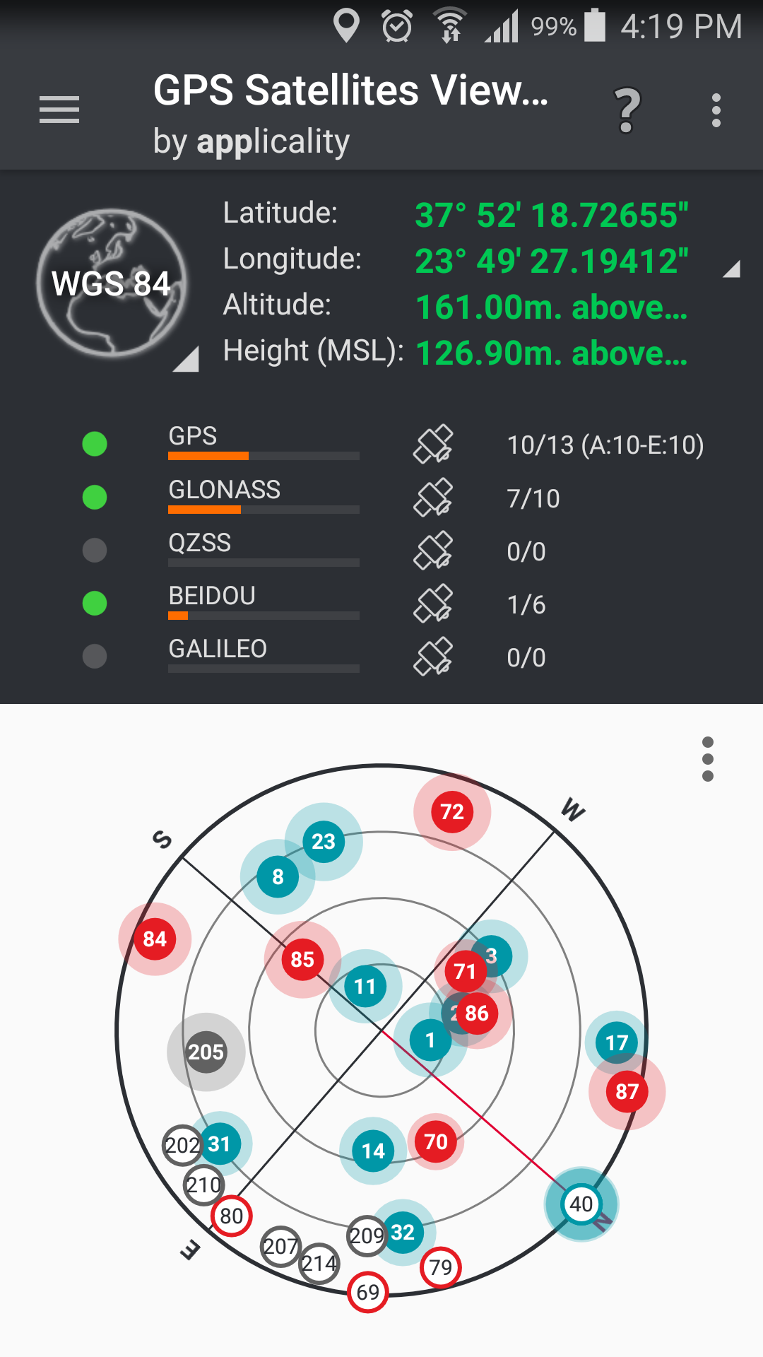
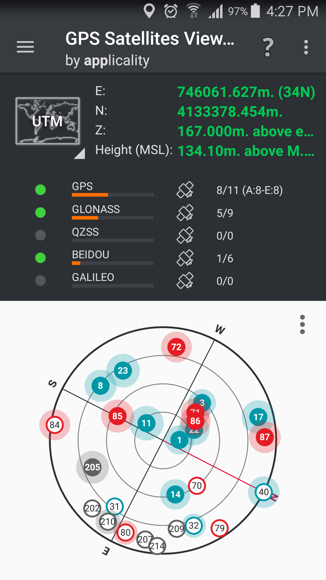
![]() Compass View:
Compass View:
… Project GNSS satellites on a compass view. Constellation, satellite ID, used in Fix, signal strength info are visible.
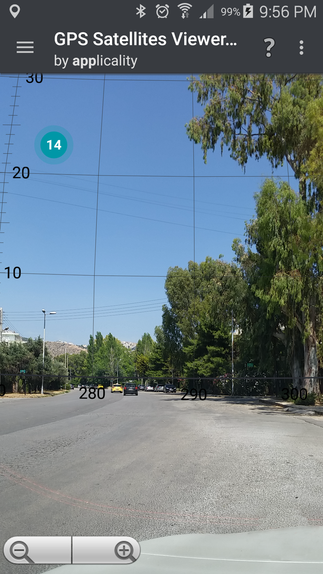
![]() Augmented Reality:
Augmented Reality:
… Project GNSS satellites on the real sky using the camera of your device. Constellation, satellite ID, used in Fix, signal strength info are visible..
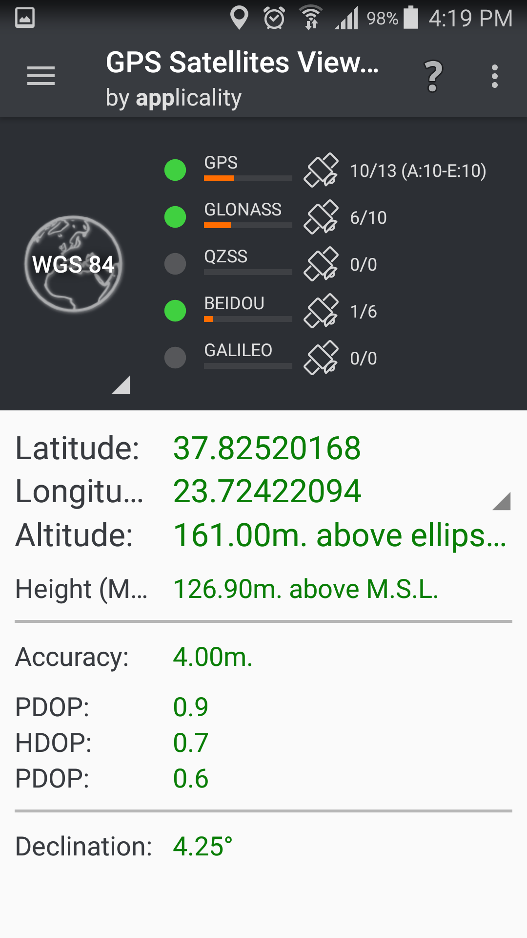
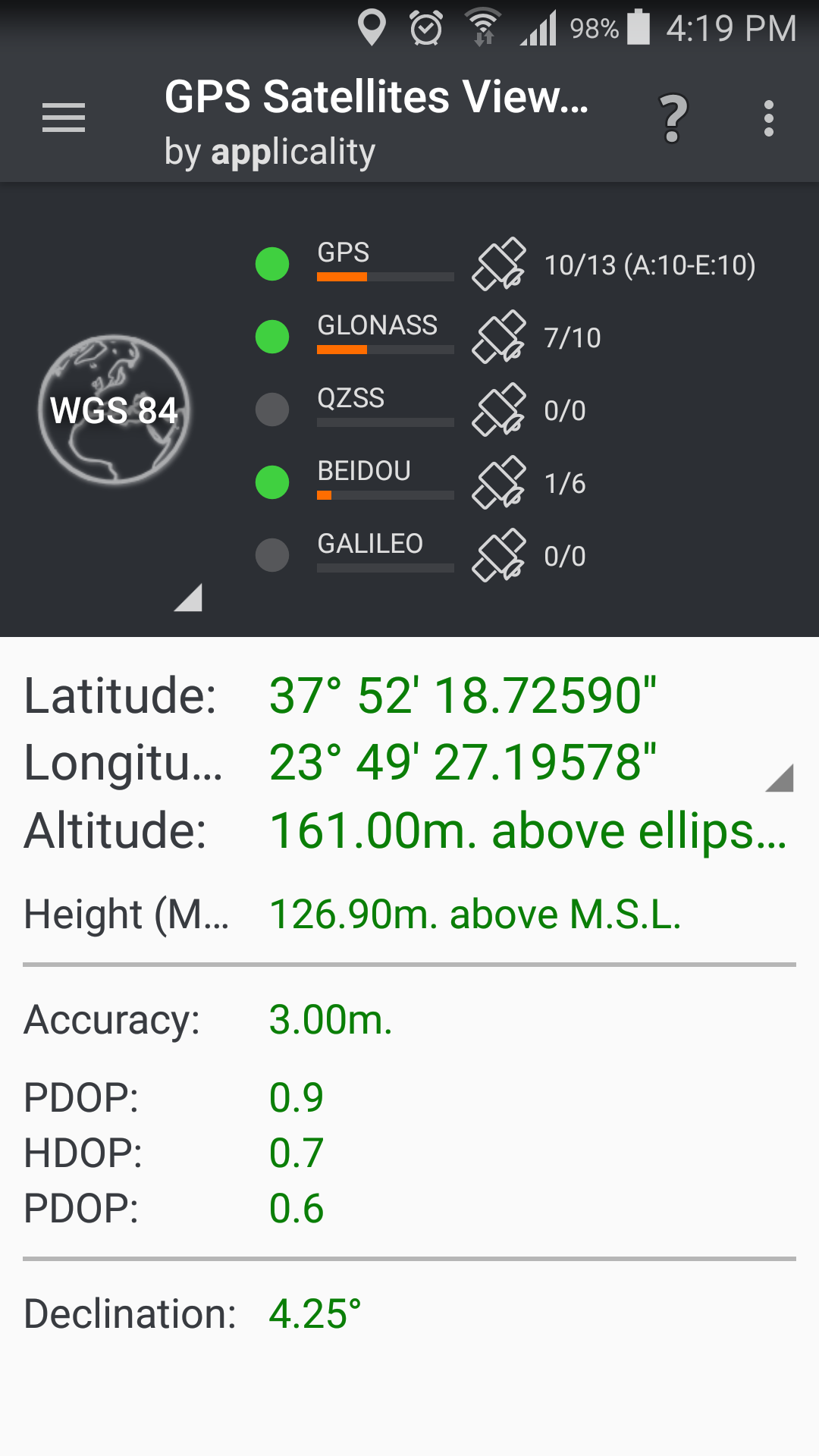
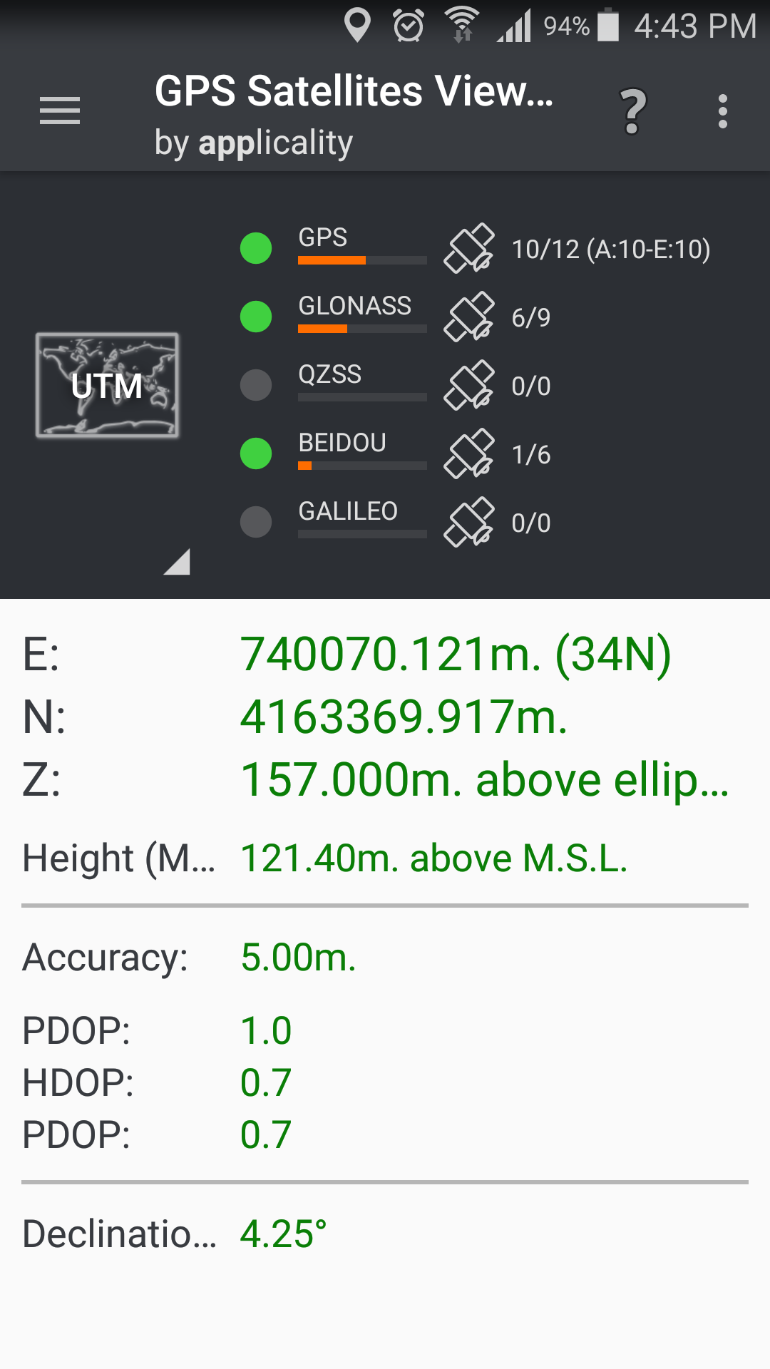
![]() Display Position:
Display Position:
… in WGS84 (Latitude, Longitude) format.
… in your local Coordinates Reference System.
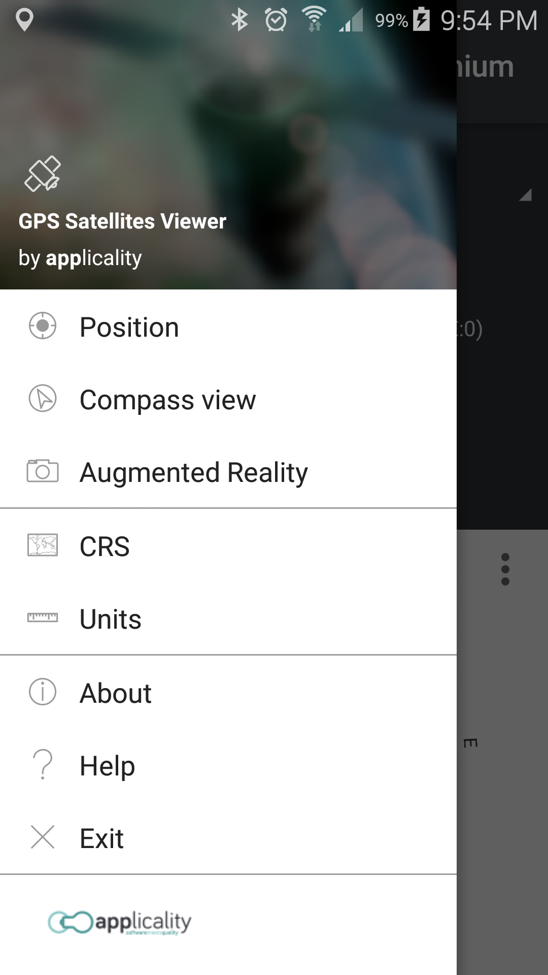
Help us improve GPS Satellites Viewer by e-mailing your comments and suggestions.

Supported Coordinates Reference Systems…
Privacy Policy