
Can a topographic device fit into your pocket?
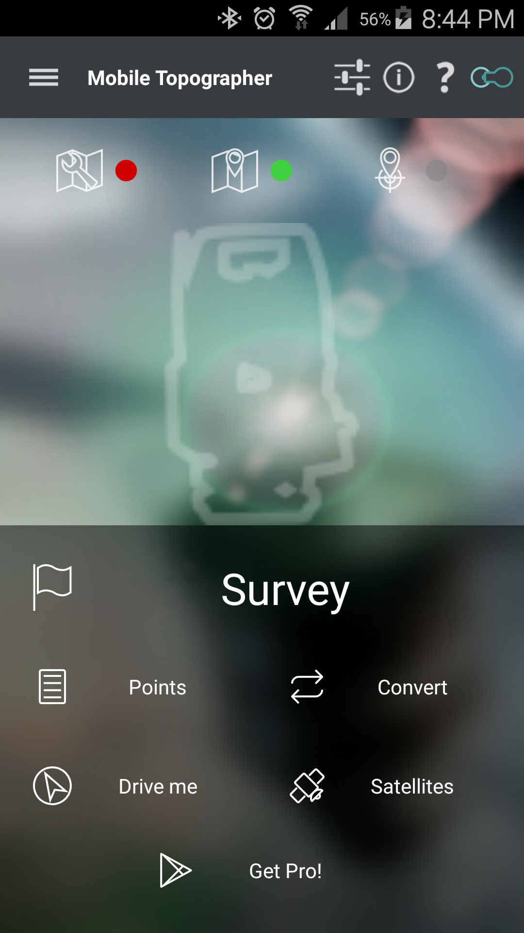
Mobile Topographer Free is an innovative app, for surveyors, and people who want to make a draft plan of their property. Use it to collect points at the field and create a drawing of the area fast, easily, and more accurate than ever before with a handheld device.
Your first step into the GIS world.
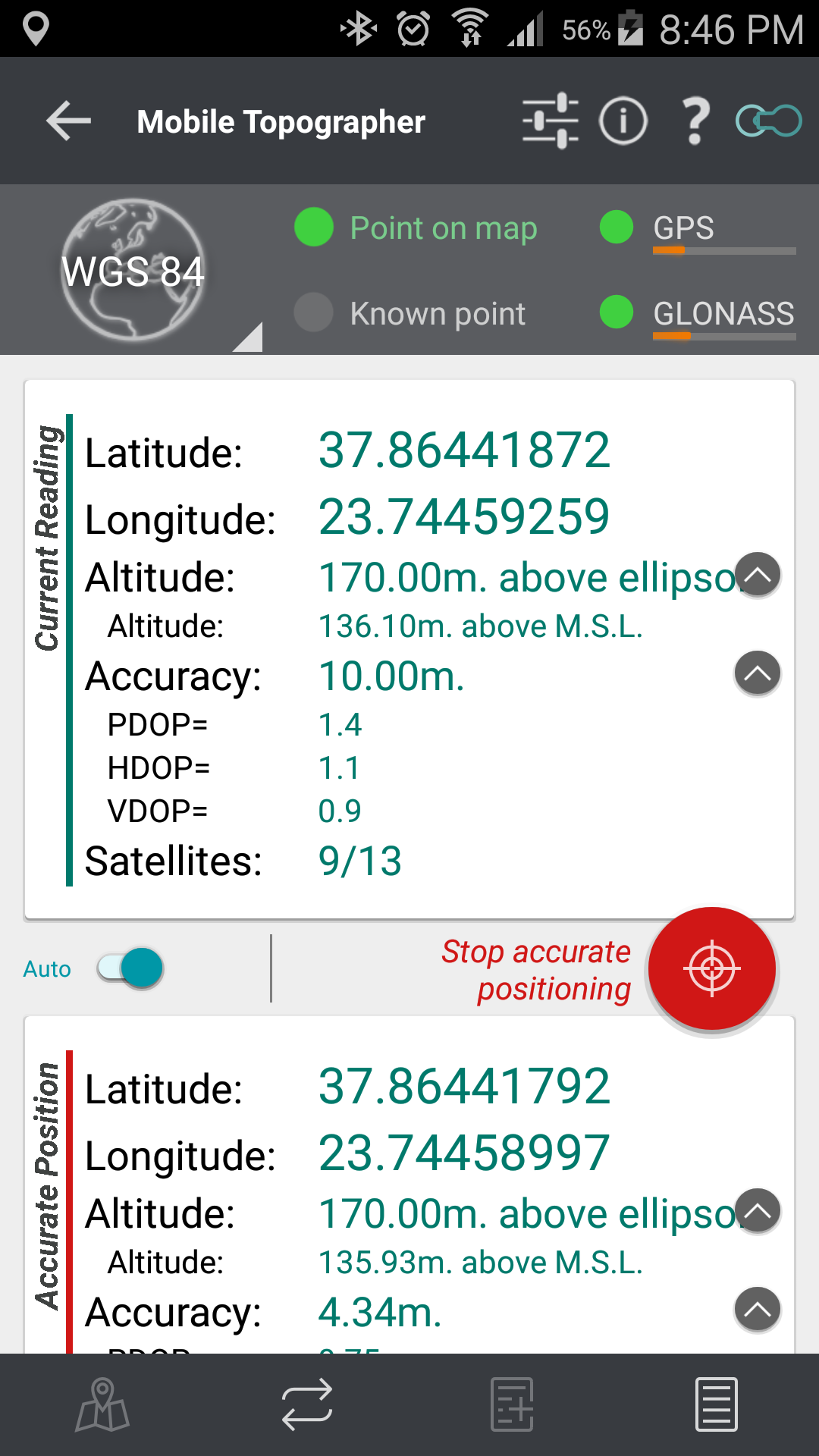
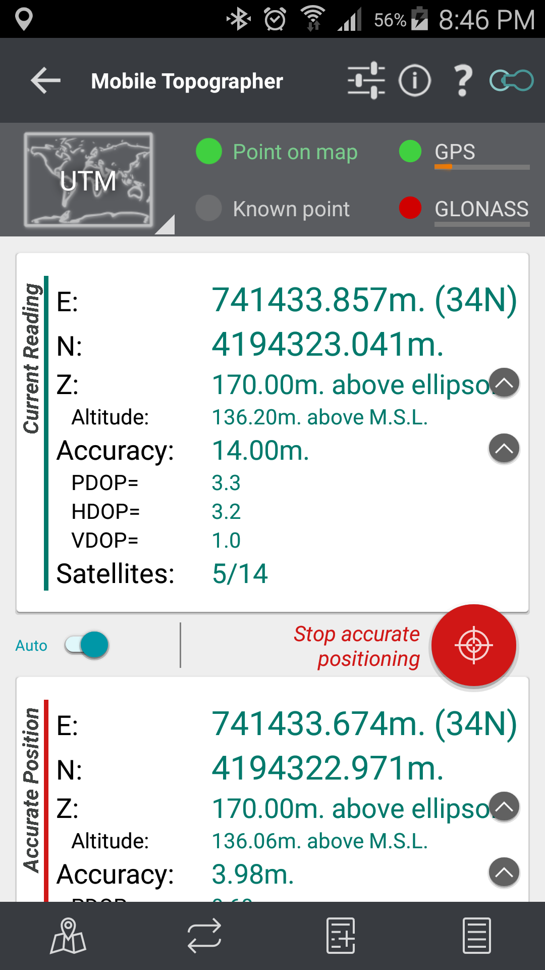
![]() Increase GPS accuracy using:
Increase GPS accuracy using:
– Weighted averaging (on every axis).
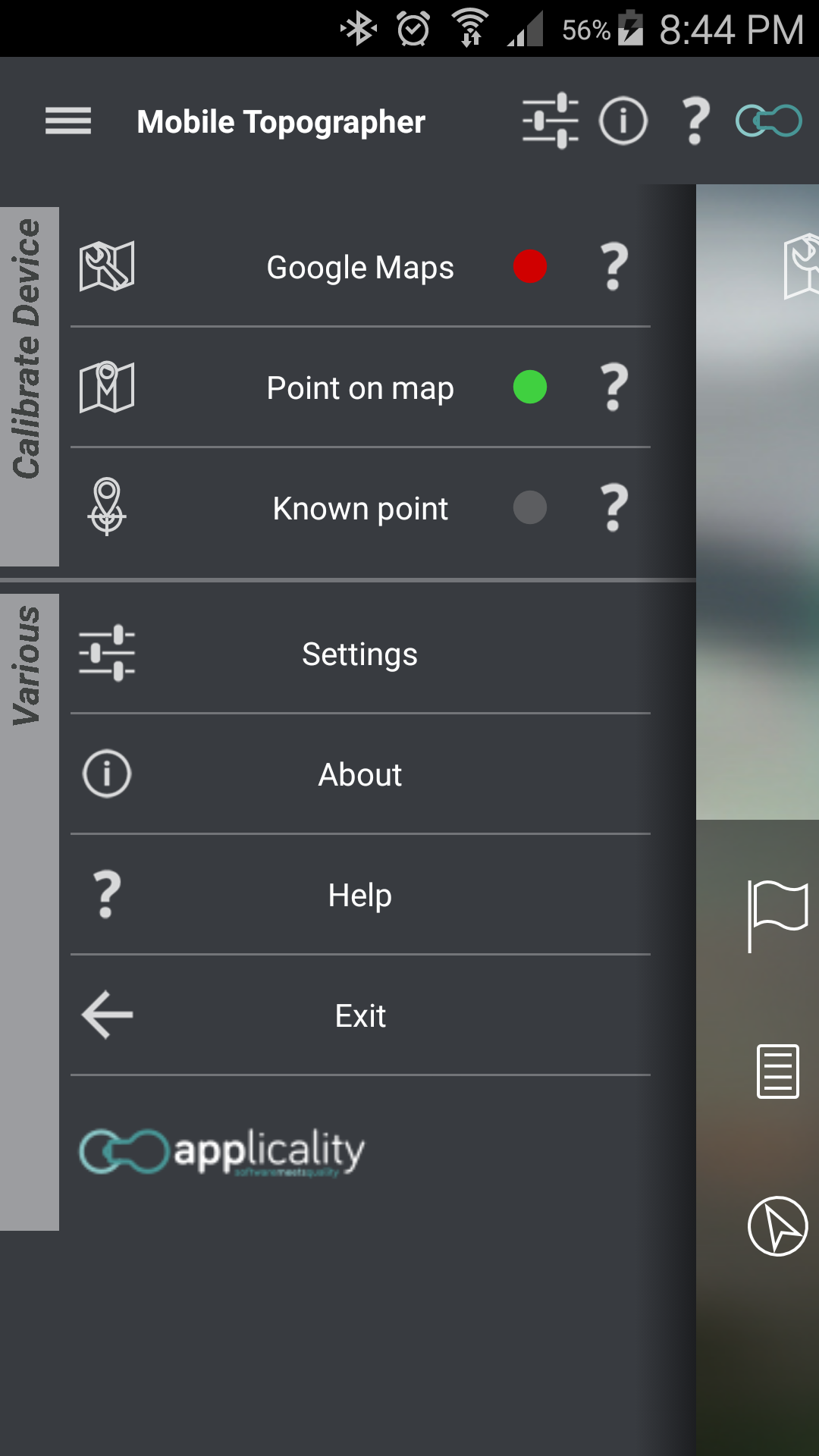
– Map calibration.
– Device calibration on map, or on a know point.
– Auto stop for accurate positioning.
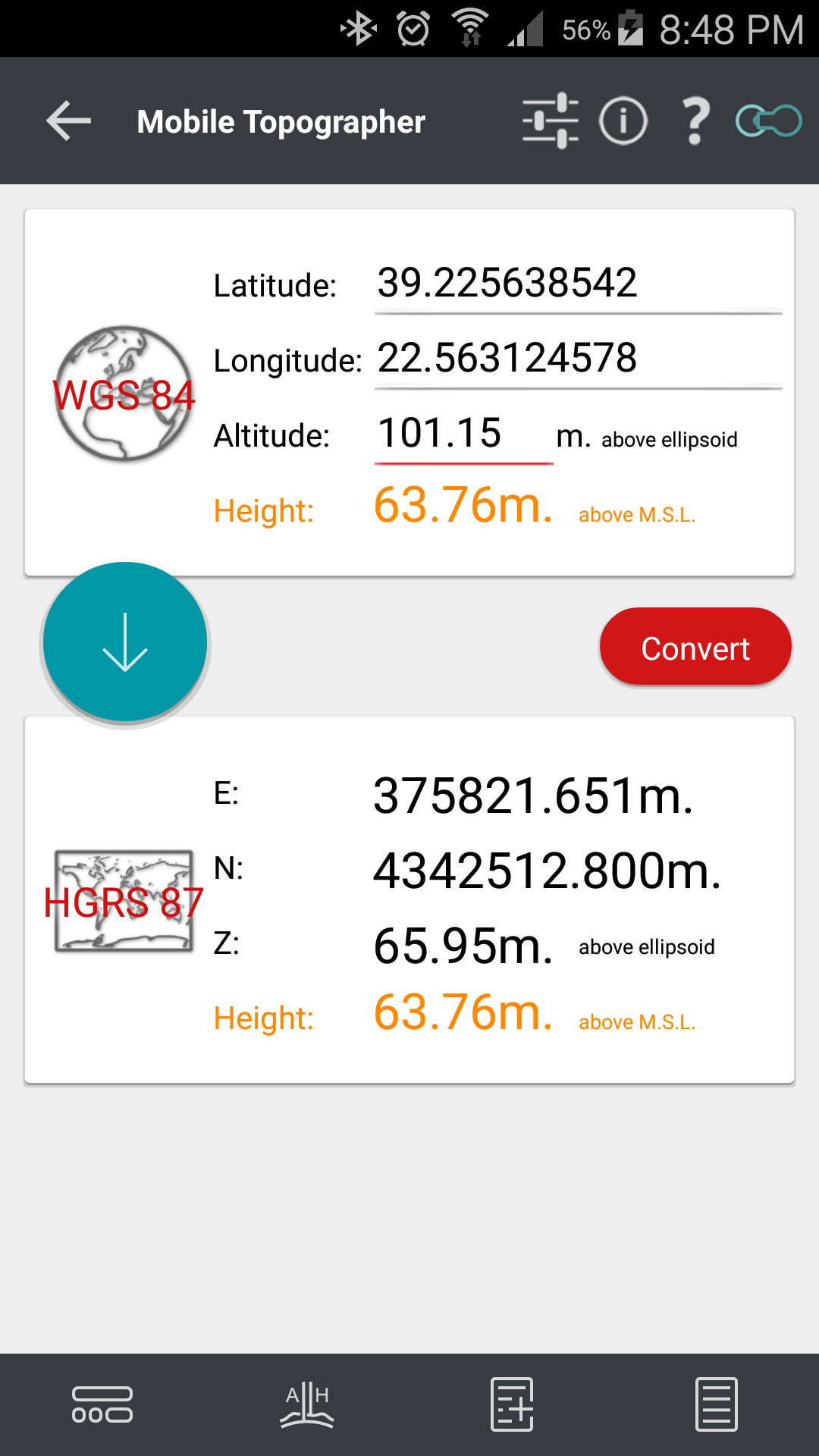
![]() Display and convert GPS geodetic to cartesian EN coordinates and back:
Display and convert GPS geodetic to cartesian EN coordinates and back:
– Real time conversion from geodetic (Latitude, Longitude) to Cartesian (E, N, Z, orthometric Height) and vise verse.
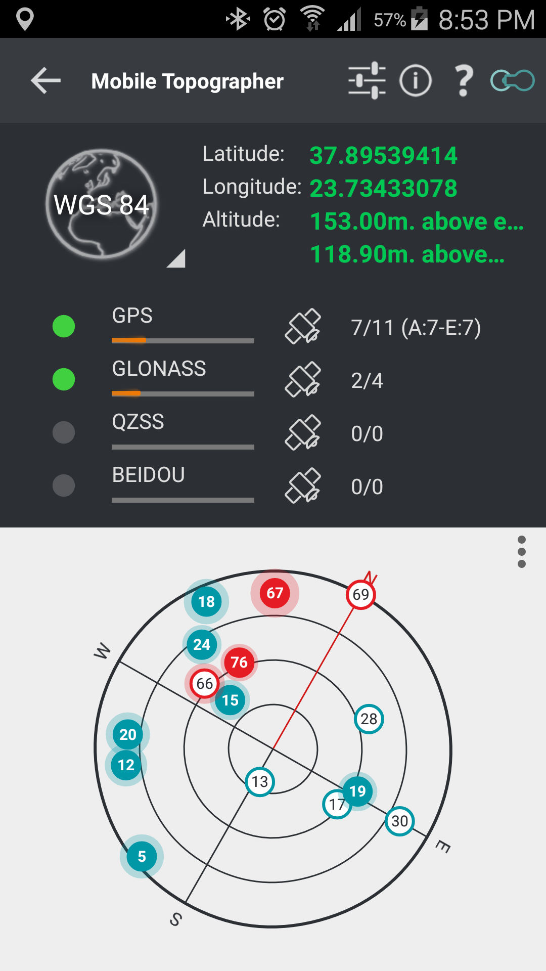
![]() Examine the satellites above you in a sky view.
Examine the satellites above you in a sky view.
![]() Signal strength and number of satellites indication for each GNSS constellation individually.
Signal strength and number of satellites indication for each GNSS constellation individually.
![]() Multiple units support:
Multiple units support:
– Metres,
– International feet,
– US survey feet.
![]() Height calculation:
Height calculation:
– Ellispoidal height.
– EGM96 orthometric height calculation.
![]() Convert from geodetic to cartesian coordinates and back:
Convert from geodetic to cartesian coordinates and back:
– Support for device measured points, or
– Manualy input of geodetic or cartesian coords.
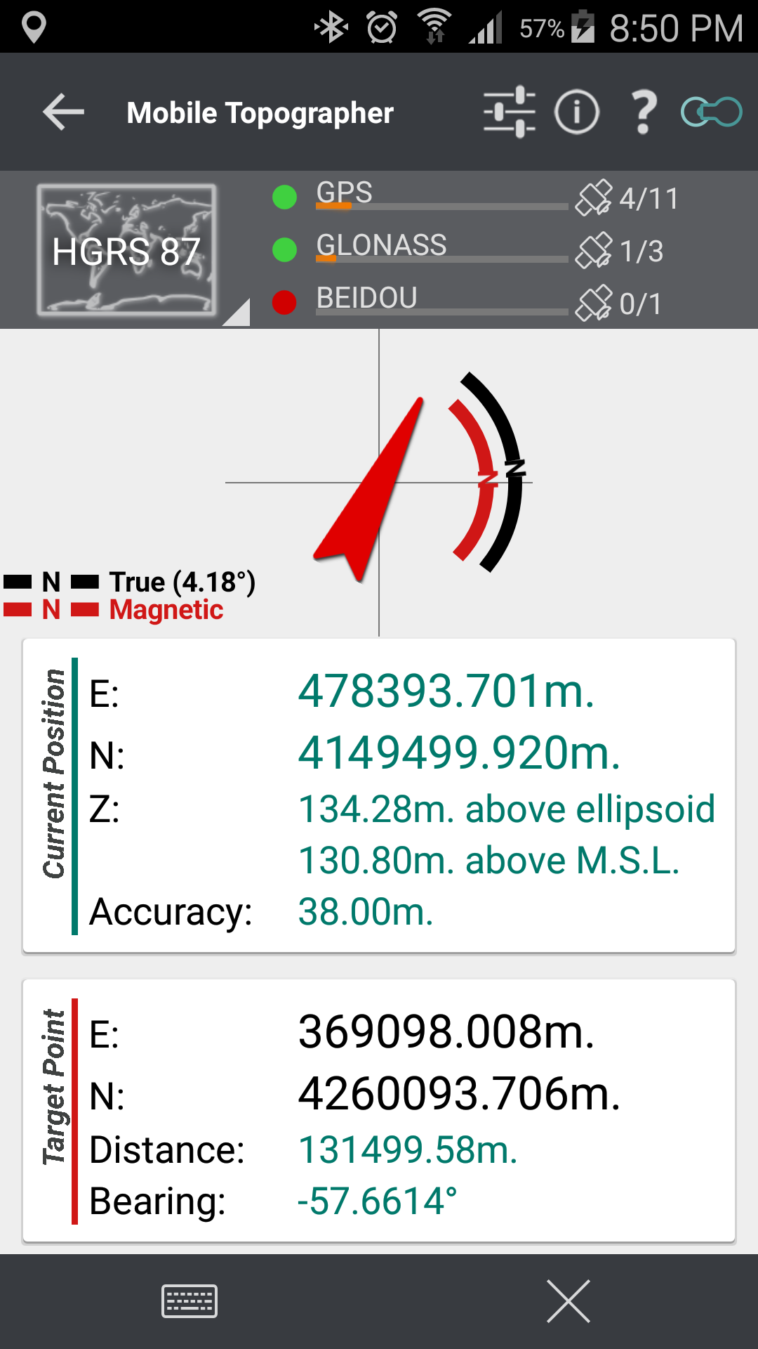
![]() Drive me:
Drive me:
– Key in coordinates of the target point in either geodetic or cartesian coordinates, or select a point from the list and follow the pointer.
– Compass indicating both magnetic and true North.
![]() Project on Map:
Project on Map:
– Project individual points on any map application.
– Project list of points, and the defined polygon, on embeded Google maps.
![]() Save multiple point lists, to use them later.
Save multiple point lists, to use them later.
![]() Calculate distance and azimuth.
Calculate distance and azimuth.
![]() Calculate area.
Calculate area.
![]() Export point lists to:
Export point lists to:
– .txt (text file)
– .csv (point file – comma seperated)
– .kml (google earth file)
– .gpx (GPS Exchange format)
– .dxf (drawing file)
![]() Send file via e-mail, or upload it to Google Drive, Dropbox, etc.
Send file via e-mail, or upload it to Google Drive, Dropbox, etc.
![]() Complete help text support.
Complete help text support.
Help us improve Mobile Topographer by e-mailing your comments and suggestions.

Supported Coordinates Reference Systems…
How to use Mobile Topographer Free…
How to import a point list file from your home computer…
Privacy Policy